

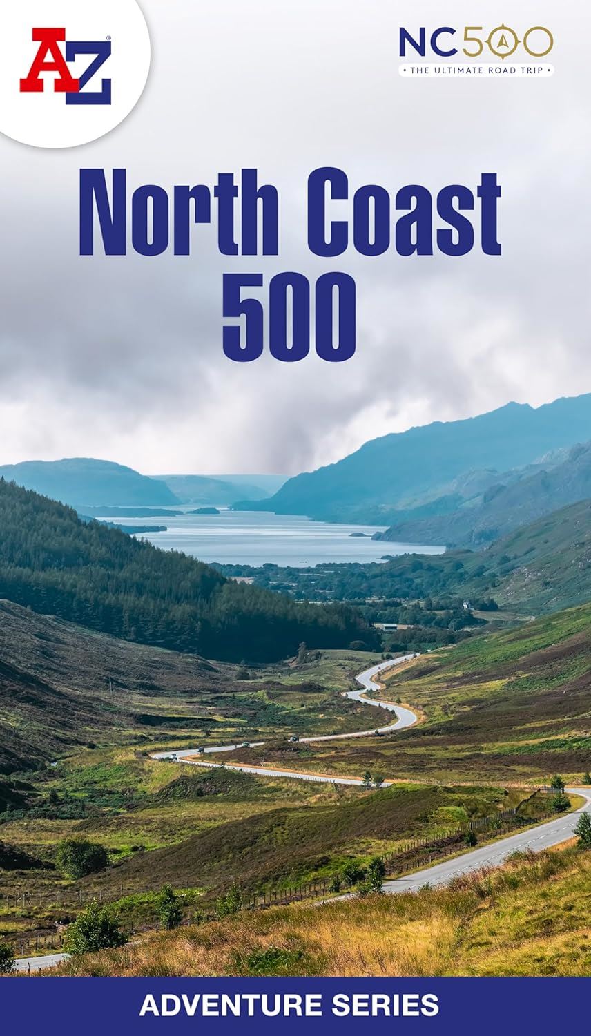
Description
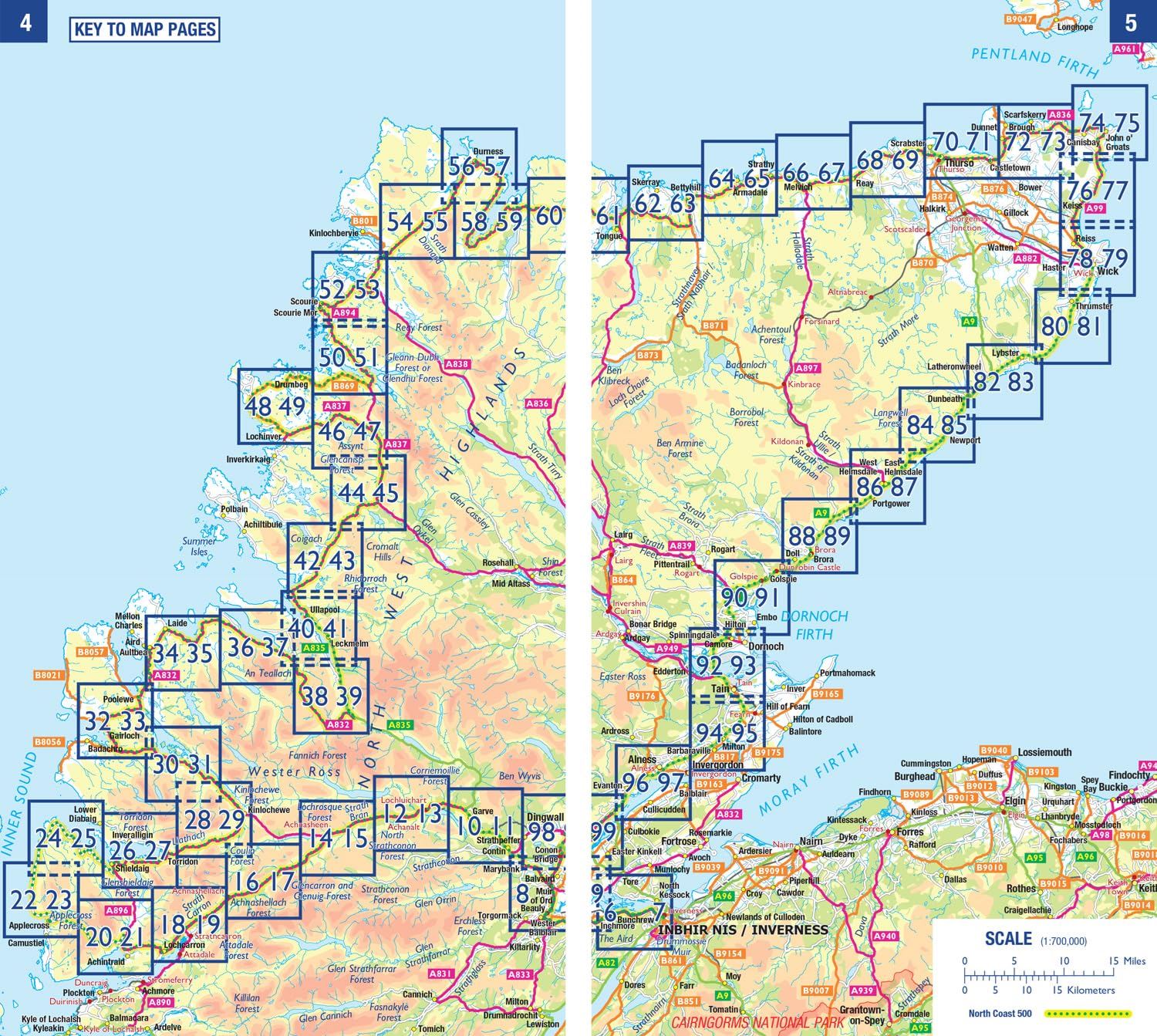
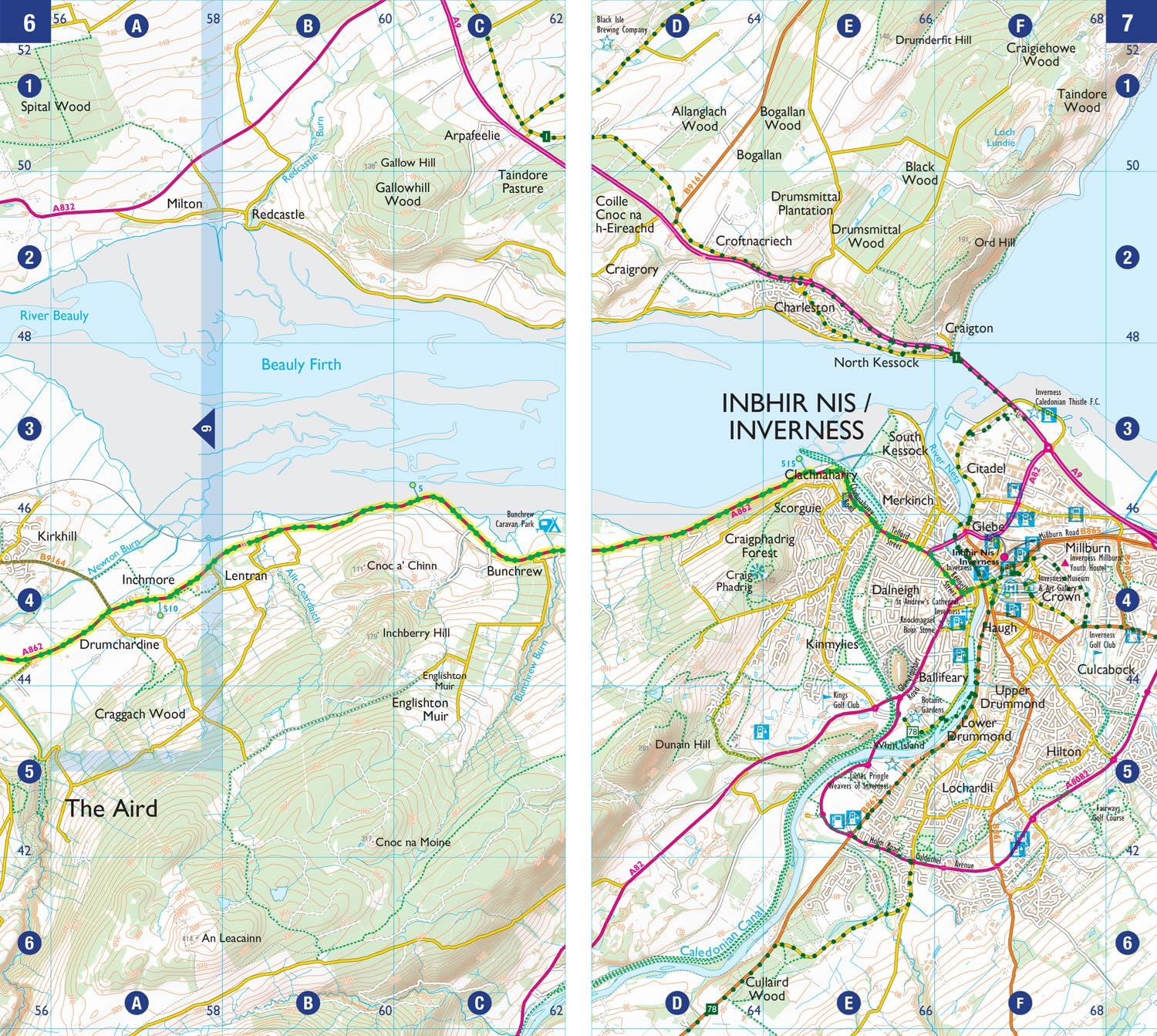
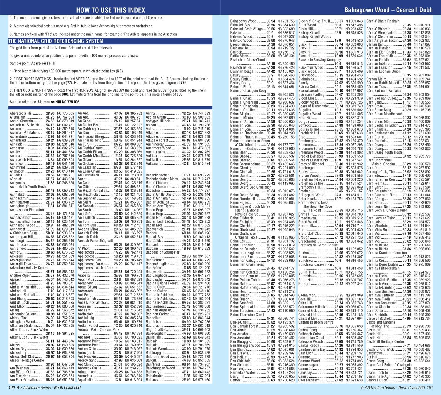
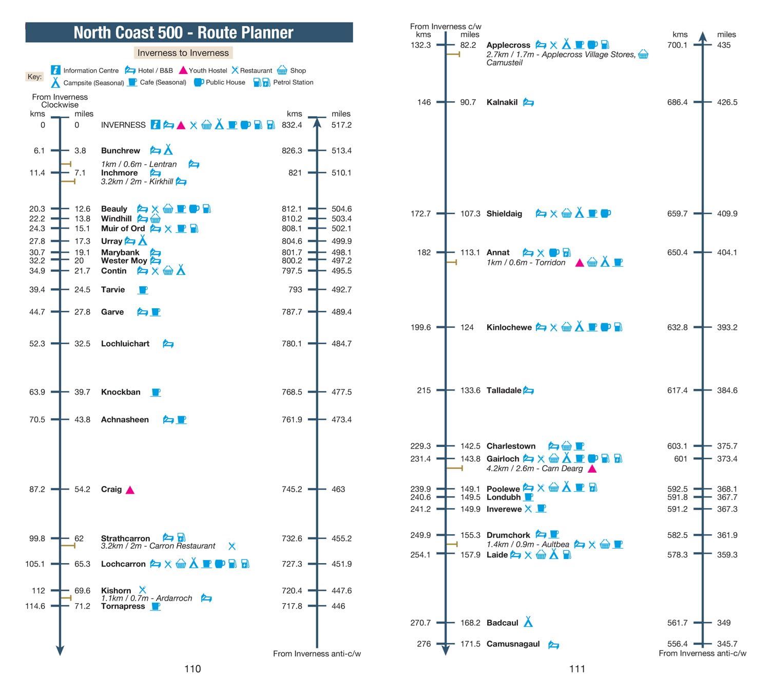
This Adventure Atlas from Geographers’ A-Z features more than 90 pages of continuous 1:50 000 mapping, providing detailed coverage of the entire NC500. A route planner shows distances between destinations and the amenities available, along with the locations of campsites (with seasonal opening), information centres, hotels and B&Bs, Youth Hostels, pubs, shops, restaurants, cafes, and petrol stations. The perfect companion for walkers, off-road cyclists, and anyone wishing to explore the great outdoors on the NC500.
Details
- Author: A to Z Maps
- Publisher: HarperCollins Publishers
- Format: Paperback
- Publication Date: 28/03/2024
- ISBN: 9780008660635
- B-Code: B070778
- Illustrated: Colour maps
- Pages: 112
- Dimensions: 240x134mm
Size