

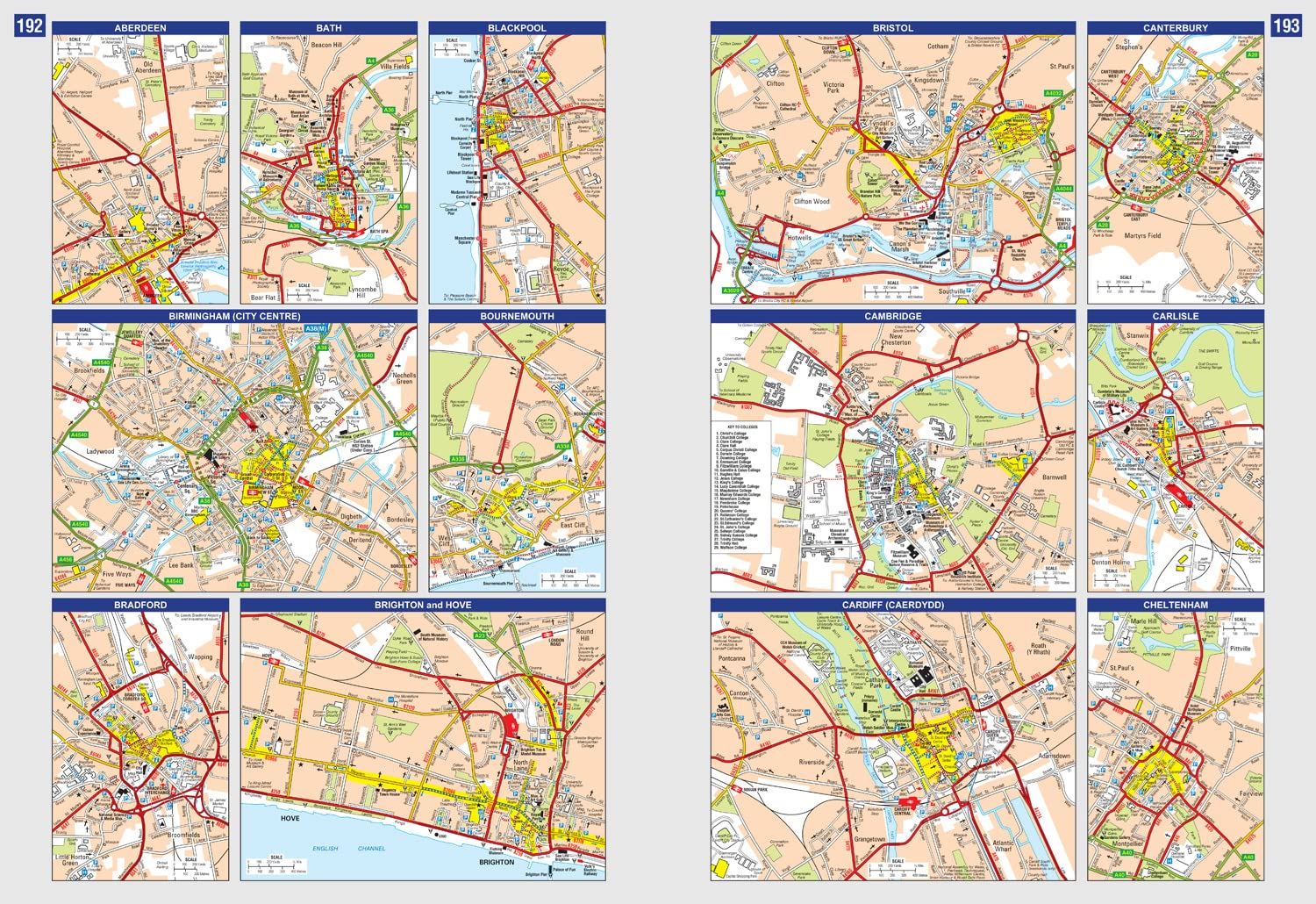
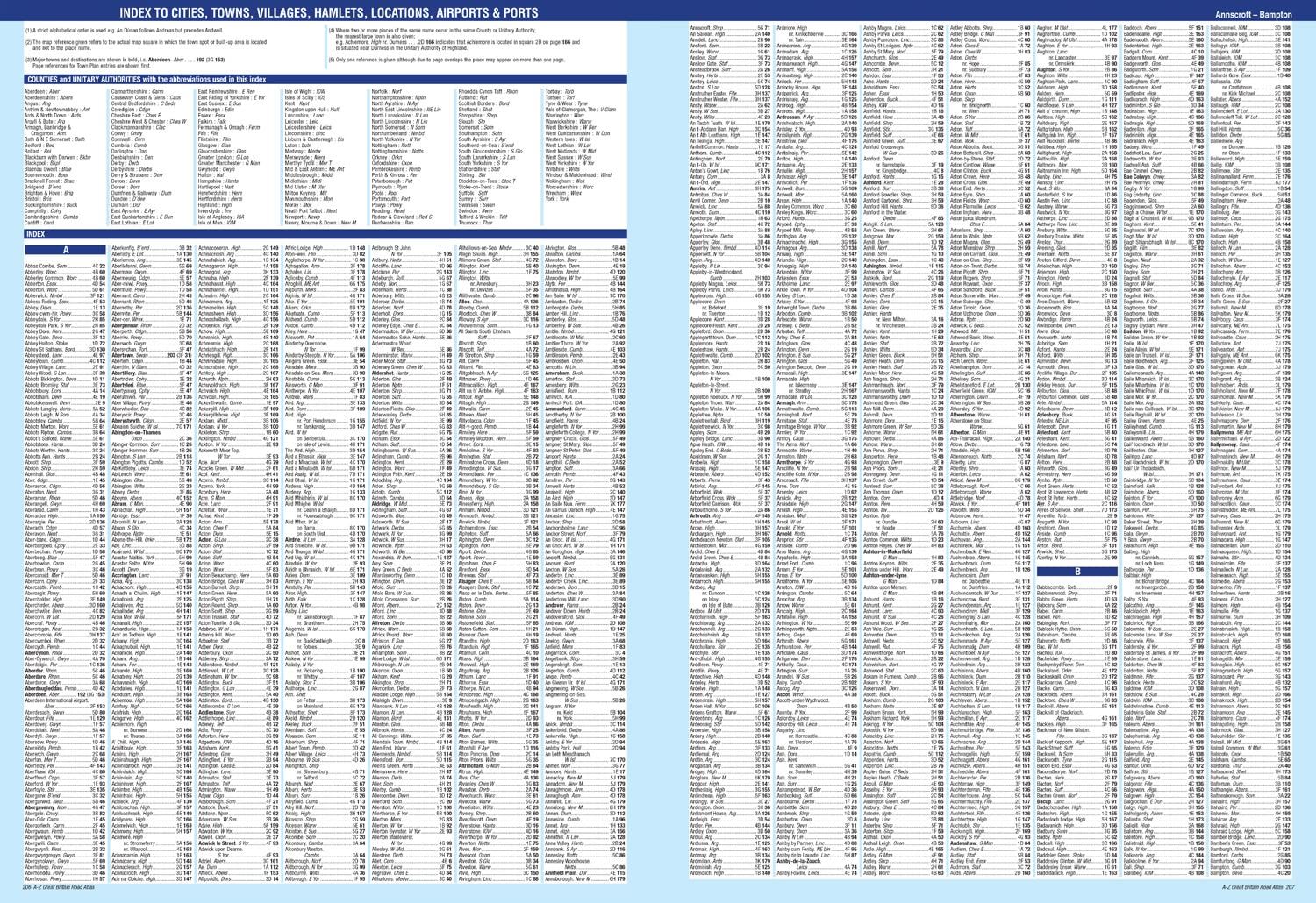
Description
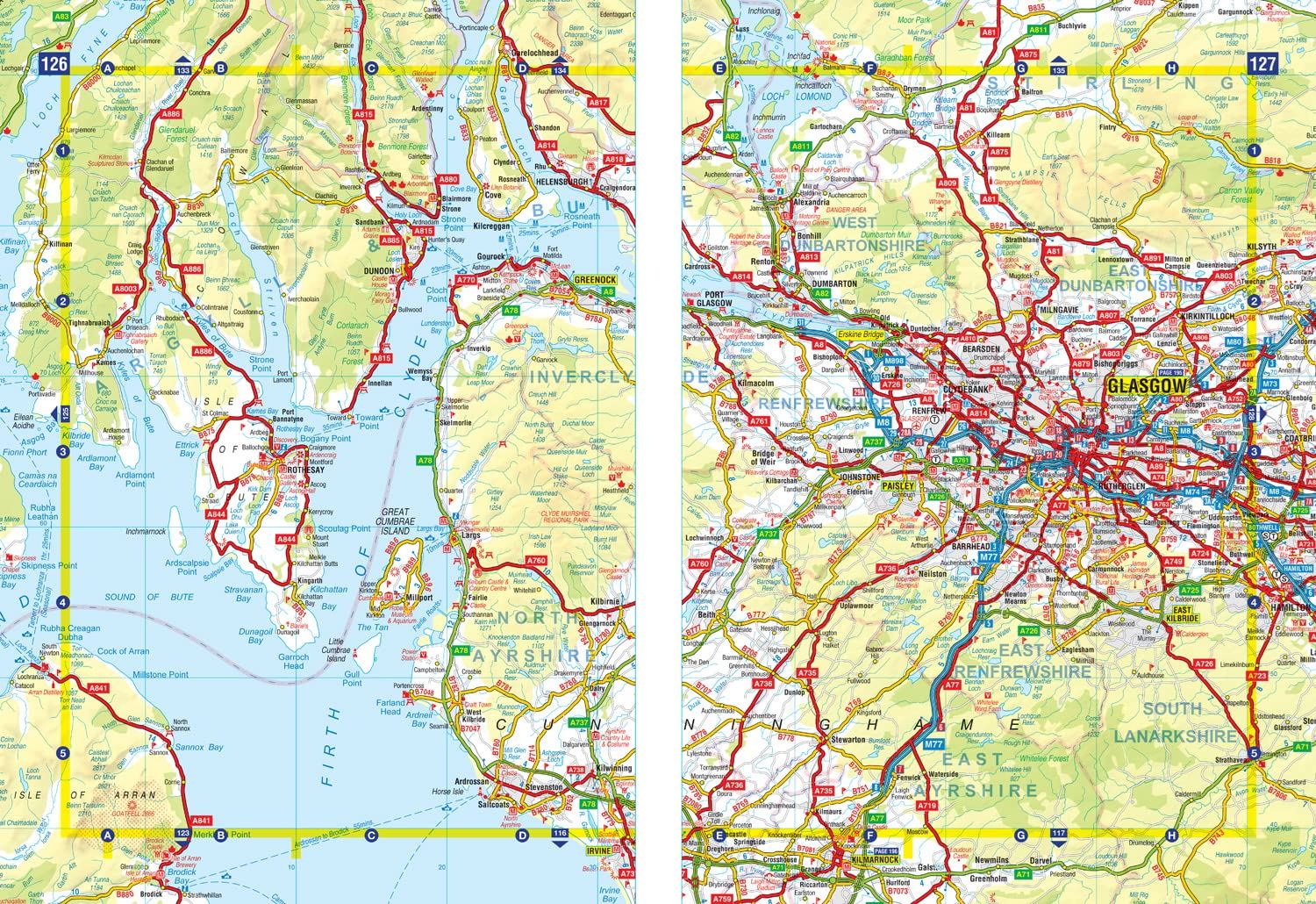
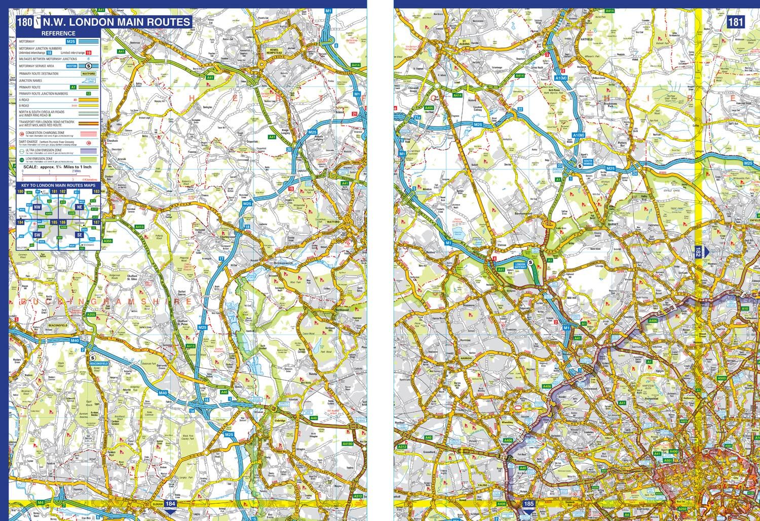
A easy-read, spiral bound road atlas, now fully revised and updated. Clear detailed road mapping at a mainland map scale of 2.5 miles to 1 inch. Published in a large easy-to-read A3 format. Features include: route mapping covering Greater London, Birmingham and Manchester, 70 city and town centre street plans, 16 port and airport plans, and Channel Tunnel terminus maps. Also included is a full index to cities, towns, villages, hamlets, major destinations and selected places of interest with postcodes for sat-nav use.
Details
- Author: A-Z Maps
- Publisher: HarperCollins Publishers
- Format: Paperback
- Publication Date: 13/04/2023
- ISBN: 9780008597658
- B-Code: B067783
- Illustrated: Full colour
- Pages: 248
- Dimensions: 379x276mm
Size